If you’re one of those hikers who loves a good challenge, then look no further than the Hannah Mountain Trail in the Great Smoky Mountains National Park. The trail is a meandering 9.5 miles from Parson Branch Road to its junction with the Hatcher Mountain Trail at Abrams Creek.
You’ll trek across a number of Smoky Mountain ridges along the way after starting out on Parson Branch Road. To get there, turn off the Cades Cove Loop Road in Townsend just past the Cable Mill. Then follow the signs to Parson Branch Road.
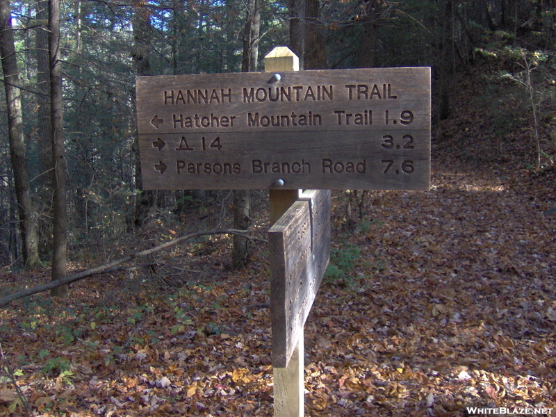
Over the years, this trail has become known for its great hiking opportunities. And by that, meaning it’s a very even trail and smooth thanks to pine needles that fall along it. You’ll come to a massive tuliptree 1.9 miles on the trail – the first major natural marker. Accordingly, another natural marker found on Hannah Mountain is Mount Lanier, the mountain’s highest peak. You’ll descend its flank above Bell Cove and hike into a mixed hardwood forest.
Hikers will circle the north end of Hannah Mountain as they move further along the trail before coming to backcountry campsite No. 14. From there, hikers will follow the trail around the north end of Deadrick Ridge. You’ll climb Polecat Ridge after passing an old home site. This occurs before descending Scott Gap 7.6 miles in. Scott Gap is named in honor of George Scott who lived in the area that backcountry campsite No. 16 now occupies.
The Hannah Mountain Trail reaches its steepest point during the final 100 yards as it approaches Abrams Creek. You must wade the creek in order to cross it which can be hazardous after a rainstorm. Happy hiking!